Sitecomp
A Simple Name For An Extraordinary Survey Platform
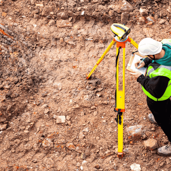
SiteComp Survey enhances everything surveyors already do delivering greater accuracy, smarter workflows, and modern spatial intelligence powered by advanced point-based technology.


ABOUT PLATFORM
Welcome To SiteComp Survey Technology
With more than 30 years of successful collaboration with both public and private partners, SiteComp Survey has established itself as a reliable solution for surveying, mapping, and land development industries.
Built on advanced spatial intelligence, the system improves project accuracy while simplifying complex design workflows.
- Advanced Point-Based Survey System
- Designed For Spatial Disciplines
- Reliable Industry-Proven Technology


Years Experience
Who We Are
We Specialize In Advanced Survey & Mapping Solutions
SiteComp Survey is developed around spatial design principles, allowing professionals to manage coordinate-based information with precision and efficiency.
Years Experience
Decades of continuous software innovation focused on surveying and land development industries.
Best Technology Team
Driven by advanced geospatial engineering and modern data representation systems.
Unlimited Possibilities
Flexible infrastructure adaptable to evolving project requirements.
Discover Our Core Technology Advantages
Bring Your Ideas
We Have Expertise To Transform Survey Data Into Intelligent Design
Combining years of point-based software development with modern geospatial advancements, SiteComp Survey delivers next-generation survey representation for complex land projects.
High-Quality Survey Software Built On Innovation
At the core of SiteComp Survey lies CDIS — Coordinate Design Information System — a fully point-based technology designed specifically for spatial industries.
take the time to understand
We Work Closely With You To Deliver Smarter Survey Solutions
Our system replaces outdated linear applications with intelligent spatial representation built for modern surveying demands.
Software Walkthrough Video
Our Patent
Patented Technology
A coordinate design and information system (CDIS) combining coordinate geometry, spatial features and drafting into one package. CDIS uses an object-oriented and spatial-based approach in which all objects have a set of attributes, while space and areas are defined and tracked.
The invention has such features as incremental numbering with automatic parceling, duplicating a cluster, pulling a line tangent to a curve, erasing figures by type, converting lines to polylines, computing an average radius from digitized points, wiping out triangles greater than a certain length, exploding a text file inserted as multi-line text into individual lines of text, and specifying parcel report precision.

White Paper: SiteComp Survey: Built on Coordinate Design and Information System (CDIS) Technology
This whitepaper introduces SiteComp Survey, an extraordinary software solution for the land surveying and mapping industries. Unlike most survey software products, SiteComp Survey is not based on a CAD (Computer-Aided Design) core engine. SiteComp Survey is based on Coordinate Design and Information System (CDIS), an engine which was created specifically for design disciplines that require geospatial analysis.
Download Center
Get the Software
Version 11
- Latest features & updates
- Improved performance
- Security patches
- Full support
Client Feedback
We provide our clients with the most innovative and effective
“For those who have spent years trying to find the ideal surveying program, I strongly recommend SiteComp Survey. This is truly one of the best survey programs I have ever sampled.“
Joe Bell is licensed in California and New Mexico. He has been reviewing software for surveyors since 1982.